
A digital elevation model (DEM) and Topographic Wetness Index (TWI) for Mississauga, Ontario. TWI estimates where water tends to collect, from how much area drains into each cell and how steep it is:
View the full interactive report → · Code on GitHub
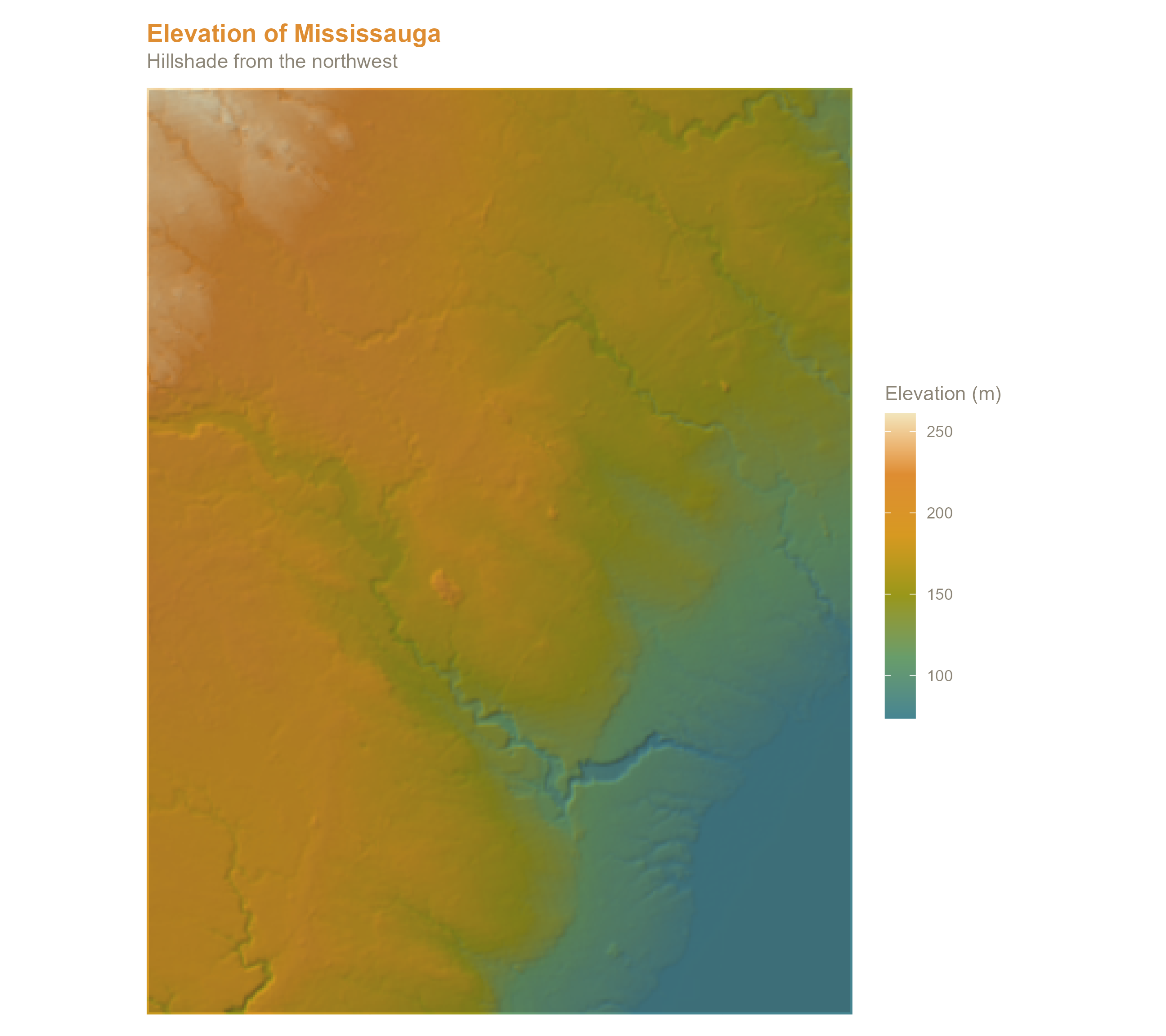
Elevation
Wetness index, in R and in ArcGIS
The original version of this project calculated TWI in ArcGIS. The revised version calculates it entirely in R with terra: D8 flow direction and flow accumulation from the sink-filled DEM, slope, then TWI, all in a projected coordinate system so cell sizes are true ground distances.
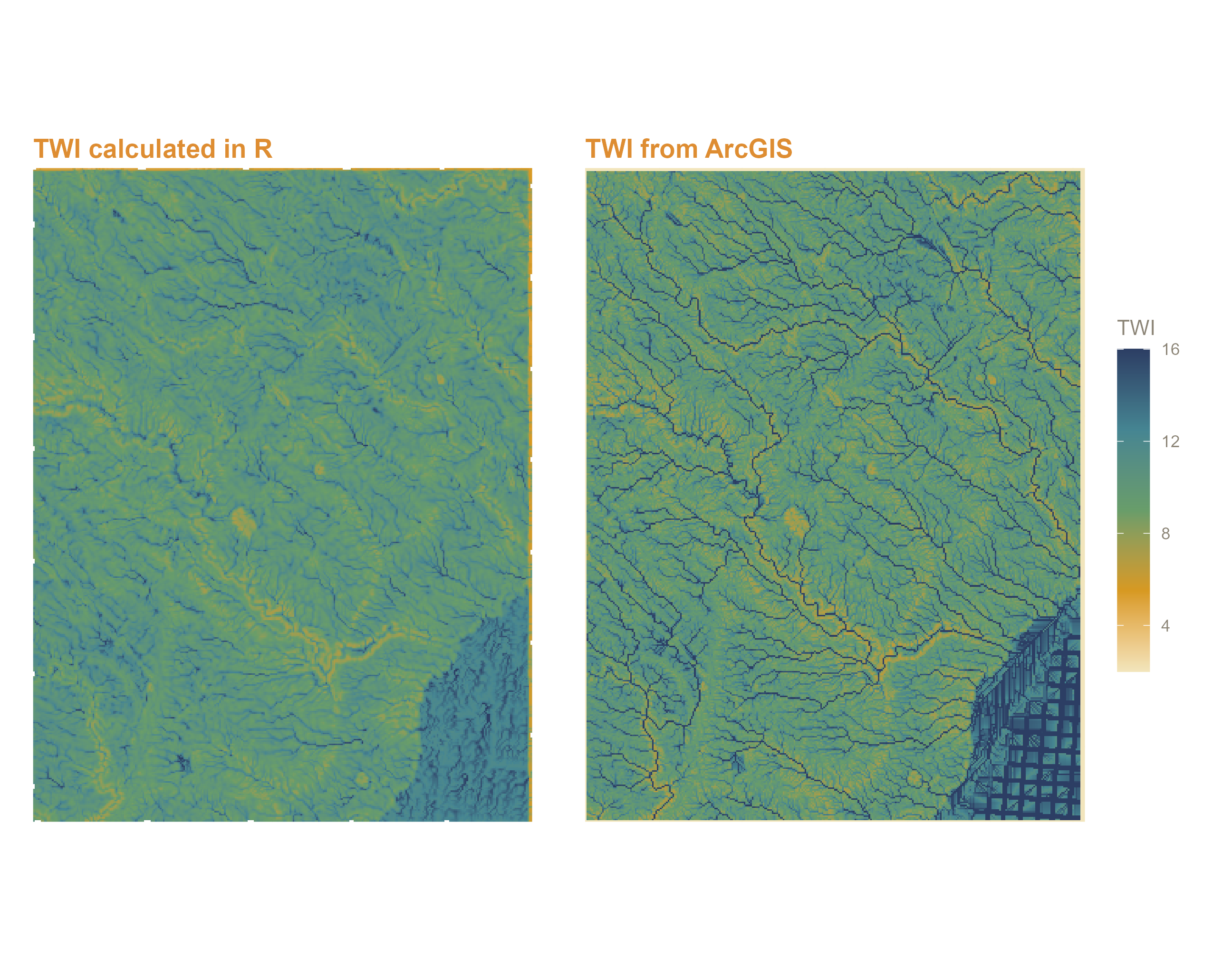
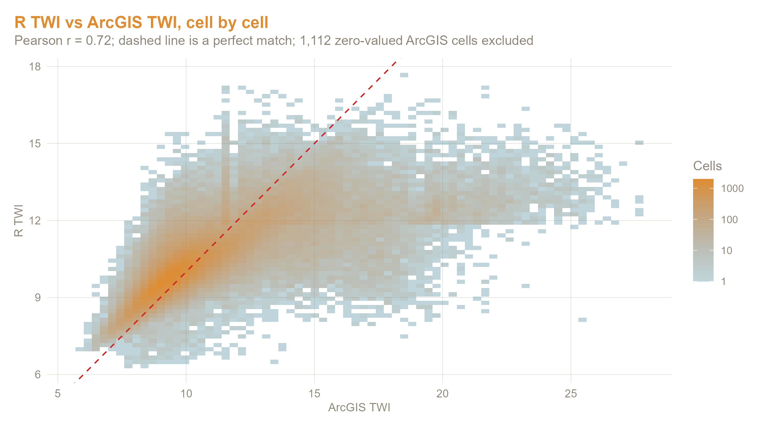
The two agree well overall (Pearson r = 0.72). Differences come mostly from how each tool routes flow across flat areas and edges.
What’s in the report
- Hillshaded elevation map and summary statistics
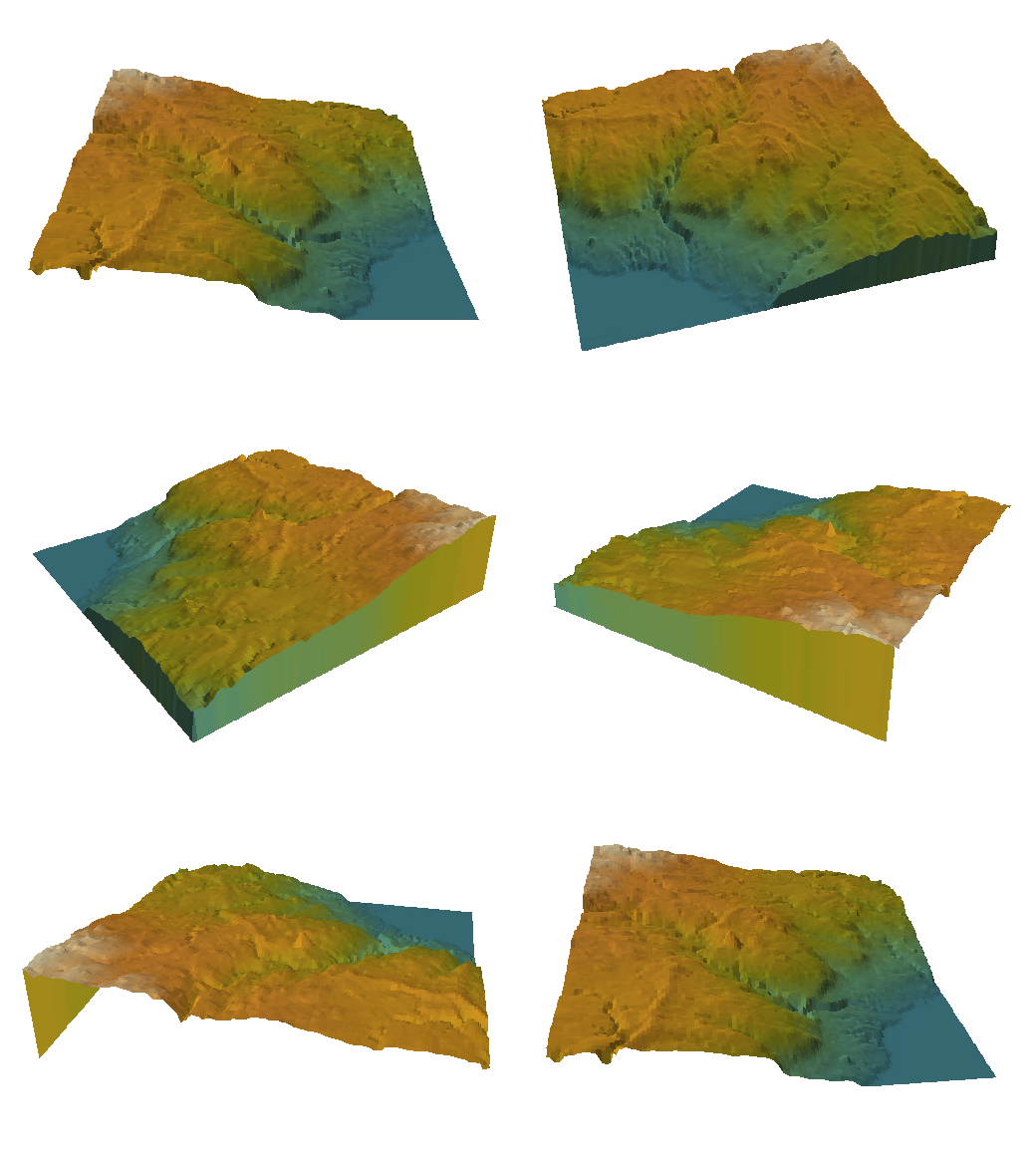
- Perspective views and the rotating 3D view above
- Where sink filling raised the DEM, and by how much
- TWI calculated in R, compared cell by cell with the ArcGIS TWI
- Interactive map with switchable elevation and TWI layers
Tools
R (terra, ggplot2, patchwork, leaflet, gifski) and ArcGIS Pro.